White Paper
Download our UAV comparison white paper PDF comparing the top aerial UAV models in both photogrammetry and LiDAR to provide the best solutions for your company’s needs.
Get the white paper.
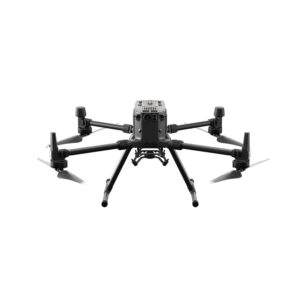
DJI Matrice 300 RTK + L1
Matrice 300 RTK + L1 forms a complete solution that gives you real-time 3D data throughout the day, efficiently capturing the details of complex structures and delivering highly accurate reconstructed models.
Package includes: Matrice 300 RTK, Intelligent Battery Station, 2 Batteries, Zenmuse L1 LiDAR Sensor (Includes 6 months DJI Terra Pro), TB60 Intelligent Flight Battery, and WB37 RC Battery.
$29,158
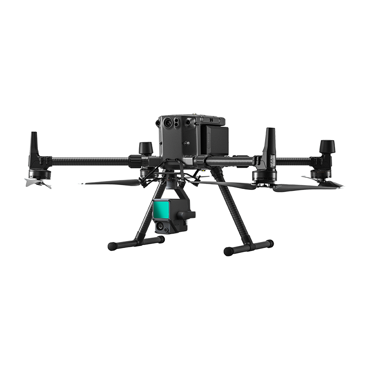
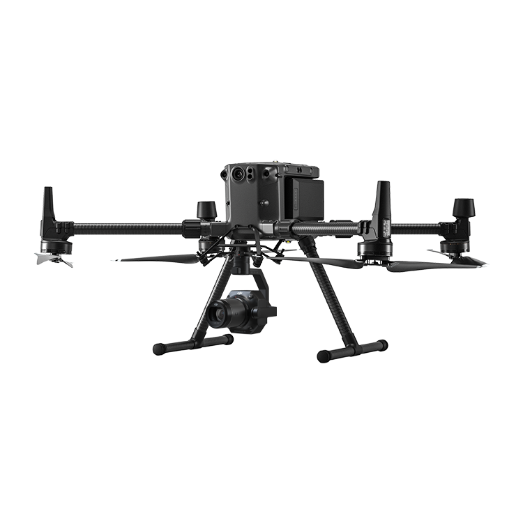
DJI Matrice 300 RTK + P1
Matrice 300 RTK + P1 Full Frame Sensor Payload, this package delivers centimeter-level accuracy and highly scalable images
for 3-D mesh maps, 2-D orthomosaic mapping, and many
more applications.
for 3-D mesh maps, 2-D orthomosaic mapping, and many
more applications.
Package includes: Matrice 300 RTK, Intelligent Battery Station, 2 Batteries, Zenmuse P1 45MP Photogrammetry Payload, TB60 Intelligent Flight Battery, and WB37 RC Battery.
$22,308
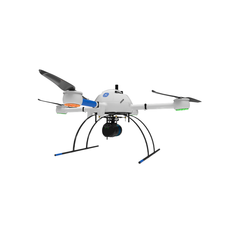
Microdrones mdLiDAR1000LR
mdLiDAR1000LR means longer range. You’ll cover more ground from above. mdLiDAR1000LR is a fully integrated system for producing 3D point clouds optimized for land surveying, construction, oil & gas and mining applications.
Package includes: Microdrones mdLiDAR1000LR aaS, md4-1000 UAV, mdWaypoint Navigation, mdLanding Assistant Battery Charger, Rugged Case, Tablet Mount, Data Link md1000LR with Integrated APX-15 and 26MP Camera, GNSS Antenna and Cables, Tokens for Data Processing Modules, md4-1000 Flight Battery, Support for mdLiDAR1000 for a Year, and mdLiDAR1000 aaS Type Training.
$73,045
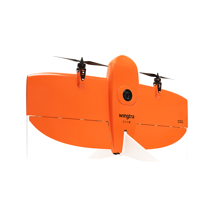
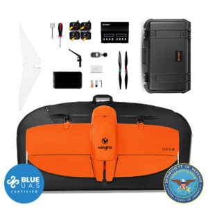
WingtraOne Gen II
The WingtraOne GENII PPK UAV is a fully autonomous, professional-grade fixed-wing vertical takeoff & landing (VTOL) drone designed specifically for long-distance / large-area surveying applications.
Package includes: WingtraOne Gen II Drone, Controller, Charger, 2 Sets of UAV Batteries, WingtraPilot Flight Software, Tablet, Extra Props, Soft Case, Sony RX1 Gen II 42MP Camera Payload, and PPK Activation License.
$31,900
Trinity F90+
The Trinity F90+, due to its refined aerodynamics, reaches a flight time of 90 minutes. This makes it the system of choice for the broad variety of mapping and surveying applications. Flying large areas (1730 acres) or long distances (62 miles) per flight is easy with this efficiently working transition aircraft.
with Sony RX1II
$26,279
Package includes: Trinity F90+, RC Controller, Charger, UAV Battery, Battery Pack, QBase Flight Software, iBase Ground Reference Station, Carrying Case, Sony Rx1II Camera Payload.
with Qube240 LiDAR
$85,279
Package includes: Trinity F90+, RC Controller, Charger, UAV Battery, Battery Pack, QBase Flight Software, iBase Ground Reference Station, Carrying Case, Qube240 LiDAR Payload with 1 year CloudStation Software License, POSPAC UAV Perpetual License.

Get the white paper.
Aerial photogrammetry and LiDAR data acquisition is one of today’s top tools to help your company provide accurate deliverables in remarkably quick time frames, while saving immensely on valuable manpower. With these great advancements the business owner is now challenged to spend more time researching and comparing a wide array of manufacturers and options.
- Should we go multi-rotor, fixed-wing, or VTOL?
- Will a 20 megapixel camera fit our needs, or should we choose the 42 megapixel?
- Is LiDAR capable of getting data in dense canopy?
- Do I need Photogrammetry or LiDAR?
Precision Capture is working to answer these tough questions and many more, with an in-depth review of the top drone manufacturers and sensor options to provide the most thorough comparison to date. Download our comprehensive PDF comparing the top aerial UAV models in both photogrammetry and LiDAR to provide the best solutions for your company’s needs.