LiDAR
Light Detection and Ranging (LiDAR) is a remote sensing technology that uses rapid laser pulses to map the surface of the earth. It is useful for creating high-resolution digital surfaces and terrain and elevation models that serve various professional and commercial applications.
LiDAR Drones
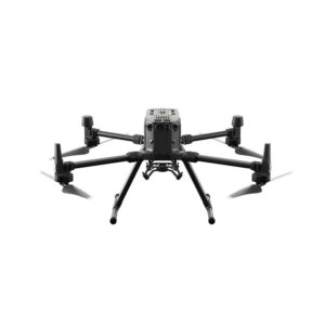
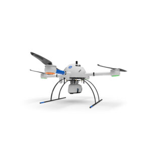
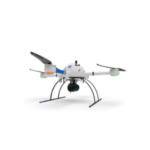
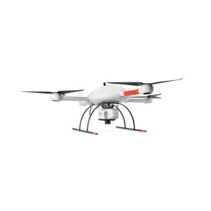
| DJI Matrice 300 RTK | Microdrones mdLiDAR1000 | Microdrones mdLiDAR3000 | |
|---|---|---|---|
| Transport Weight | 12 lbs | 62 lbs | 140 lbs |
| Transport Dimensions | 18" x 14" x 10" | 33" x 33" x 26" | 48" x 40" x 42" |
| Flight Time | 30 mins | 30 mins | 30 mins |
| RTK or PPK | RTK | PPK | PPK |
| Available Sensors | 20 MP Camera |
mdLiDAR1000LR, mdLiDAR1000HR |
mdLiDAR3000, mdLiDAR3000LR |
| Gimbal (moveable/rotating or fixed) | Movable | Fixed | Fixed |
| Real-Time Video (Sensor/First-Person View) | Yes | No | No |
| Fixed Wing vs Multi-Rotor | Multi-Rotor | Multi-Rotor | Multi-Rotor |
| Obstacle Avoidance | Yes | No | No |
| Project Area Size | 40 acres | Altitude & Speed Dependent | Altitude & Speed Dependent |
| Weather Resisting Rating | N/A | N/A | N/A |
| Battery Charge Time | 1 hr | 1 hr | 1 hr |
| Number of Batteries for Operation | 1 | 1 | 1 |
| Cruise Speed | 22 mph | 11 mph | Up to 13 mph |
| Wind Tolerance | 25 mph | 26 mph | 26 mph |