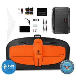
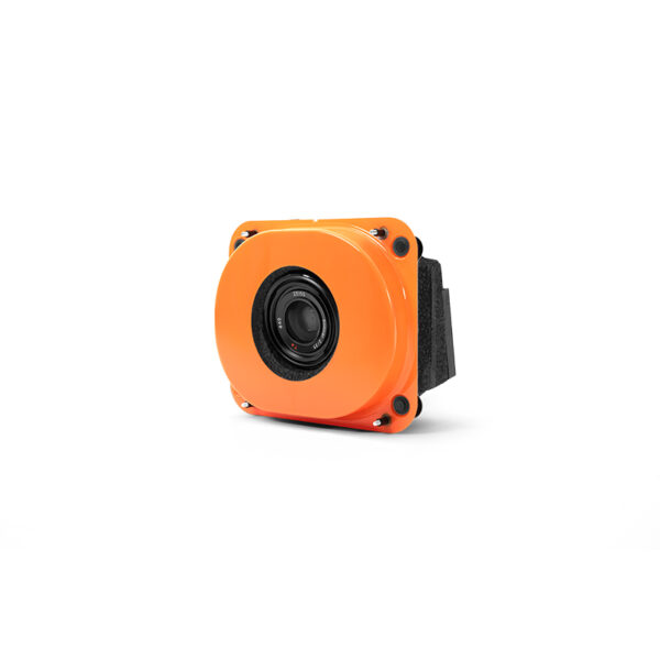
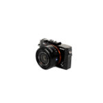
Sony RX1R II Payload Kit
 Angle")
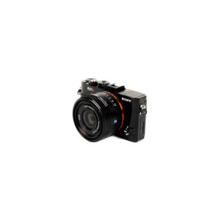

Wingtra Sony RX1R II Payload Kit (Gen 2)
$8,000.00
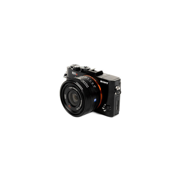
Sony’s 42 MP full-frame sensor guarantees superior image resolution for a drone camera, while the low distortion lens ensures best reconstruction results.
Request a Quote
For high accuracy surveys, Sony’s 42 MP full-frame sensor guarantees superior image resolution for a drone camera, while the low distortion lens ensures best reconstruction results.
Highest data quality
Get sharp and undistorted nadir images with high pixel density, resulting in a GSD of down to 0.7 cm / px and best-in-class absolute horizontal accuracy, down to 1 cm (0.4 in) without GCPs.
Sensor type:
Full-frame
Lowest GSD:
0.7 cm/px
Coverage at lowest GSD:
100 ha** at 57m altitude
Resolution:
42 MP
Absolute horizontal accuracy down to:
1 cm*
Coverage at 120m:
210 ha** at 1.5 cm/px GSD
* This level of accuracy can be reached together with the integrated GNSS PPK module. Learn more about how WingtraOne can reach down to 1 cm absolute horizontal accuracy.
** at 60% side overlap
Flight time, coverage and job tie
Take-off altitude above sea level:
0-500 m
0-1640 ft
Max. flight time: 54 min
Cruise speed:
16 m/s
36 mph
Max coverage at GSD 3 cm/px (1.2 in/px):
400 ha
990 ac
Max coverage at 120 m / 400 ft:
210 ha at GSD 1.5 cm/px
520 ac at GSD 0.6 in/px
Take-off altitude above sea level:
2000 m
6560 ft
Max. flight time: 42 min
Cruise speed:
18 m/s
40 mph
Max coverage at GSD 3 cm/px (1.2 in/px):
350 ha
860 ac
Max coverage at 120 m / 400 ft:
180 ha at GSD 1.5 cm/px
440 ac at GSD 0.6 in/px
Technical specifications
Technical specification: 42 MP, full-frame sensor, 35 mm lens, nadir configuration
Payload weight (incl. mount): 590 g (1.27 lb)
Lowest possible GSD:
0.7 cm/px
0.28 in/px
Maximum coverage at lowest GSD:
Up to 90 ha (230 ac) at
55 m (179 ft) flight altitude
Maximum coverage at 120 m (400 ft):
Up to 210 ha (520 ac) at
1.5 cm (0.61 in) GSD
Horizontal absolute accuracy (RMS) with PPK (w/o GCPs):
down to 1 cm (0.4 in)
Vertical absolute accuracy (RMS) with PPK (w/o GCPs):
down to 3 cm (1.2 in)
Sensor type: Full frame
Sensor size x: 35.9 mm (1.41 in)
Sensor size y: 24 mm (0.94 in)
Mega pixel: 42.4
Shutter type: Leaf shutter
Pixel in x: 8000
Pixel in y: 5320
Focal length of lens: 35 mm (1.38 in)
Focal length (35mm equivalent): 35 mm (1.38 in)
Vertical field of view: 37.8°
Horizontal field of view: 54.3°
Minimal trigger time: 0.6 s
Minimal trigger distance 9.6 m (31 ft)
GSD Overview
GSD at 120 m flight altitude: 1.5 cm/px (0.61 in/px)
Flight altitude: 120 m (400 ft)
Maximum frontal overlap: 88%
Maximum coverage: 210 ha (520 ac)
Lowest possible GSD: 0.7 cm/px (0.28 in/px)
Flight altitude: 55 m (180 ft)
Maximum frontal overlap: 74%
Maximum coverage: 90 ha (230 ac)
1.5 cm/px GSD: 1.5 cm/px (0.59 in/px)
Flight altitude: 117 m (380 ft)
Maximum frontal overlap: 88%
Maximum coverage: 210 ha (520 ac)
3.0 cm/px GSD: 3 cm/px (1.18 in/px)
Flight altitude: 234 m (770 ft)
Maximum frontal overlap: 94%
Maximum coverage: 400 ha (990 ac)
6.0 cm/px GSD: 6 cm/px (2.36 in/px)
Flight altitude: 468 m (1540 ft)
Maximum frontal overlap: 95%
Maximum coverage: 780 ha (1930 ac)
8.0 cm/px GSD: 8 cm/px (3.15 in/px)
Flight altitude: 624 m (2050 ft)
Maximum frontal overlap: 95%
Maximum coverage: 1020 ha (2530 ac)
Highest possible GSD: 25 cm/px (9.84 in/px)
Flight altitude: 1950 m (6400 ft)
Maximum frontal overlap: 95%
Maximum coverage: 2380 ha (5890 ac)
| Weight | 3.5 lbs |
|---|---|
| Dimensions | 35 × 30 × 20 in |