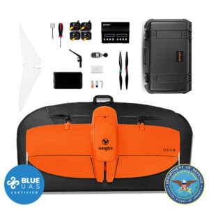
Sony a6100 Payload Kit


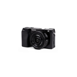

Wingtra Sony a6100 Payload Kit (Gen 2)
$2,500.00
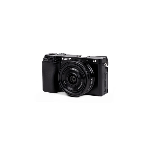
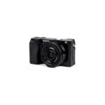
The Sony a6100 camera enables you to collect aerial data and great image quality at a ground sampling distance of down to 1.2 cm (0.47 in).
Request a Quote
The a6100 camera from Sony offers the best combination of accuracy and coverage for an affordable price.
Data quality at an affordable price
The Sony a6100 camera enables you to collect aerial data and great image quality at a ground sampling distance of down to 1.2 cm (0.47 in).
Sensor type:
APS-C
Lowest GSD:
1.2 cm/px
Coverage at 120m:
240 ha** at 2.4 m cm/px GSD
Resolution:
24 MP
Absolute horizontal accuracy down to:
2 cm* Without GCPs
Absolute vertical accuracy down to:
4 cm* Without GCPs
* Achievable with a WingtraOne GEN II and its built-in GNSS PPK module. This level of accuracy is achievable under optimal conditions, on hard surfaces, using a well-established base station or data from a CORS network. A minimum of three ground points should be used as checkpoints to verify and prove the accuracy of the project.
** at 60% side overlap
Technical specifications
Technical specification: 24 MP, APS-C sensor, 20 mm lens, nadir configuration
Payload weight (incl. mount): 550 g (0.73 lb)
Lowest possible GSD:
1.2 cm/px
0.47 in/px
Maximum coverage at lowest GSD:
Up to 120 ha (300 ac) at
61 m (233 ft) flight altitude
Maximum coverage at 120 m (400 ft):
Up to 240 ha (600 ac) at
2.4 cm (0.9 in) GSD
Horizontal absolute accuracy (RMS) with PPK (w/o GCPs):
down to 2 cm (0.8 in)
Vertical absolute accuracy (RMS) with PPK (w/o GCPs):
down to 4 cm (1.6 in)
Sensor type: APS-C
Sensor size x: 23.5 mm (0.93 in)
Sensor size y: 15.6 mm (0.61 in)
Mega pixel: 24.2
Shutter type: Focal plane
Pixel in x: 6000
Pixel in y: 4000
Focal length of lens: 20 mm (0.79 in)
Focal length (35mm equivalent): 29.8 mm (1.17 in)
Vertical field of view: 42.6°
Horizontal field of view: 60.9°
Minimal trigger time: 1 s
Minimal trigger distance 16 m (52 ft)
GSD Overview
GSD at 120 m flight altitude: 2.4 cm/px (0.93 in/px)
Flight altitude: 120 m (400 ft)
Maximum frontal overlap: 83%
Maximum coverage: 240 ha (600 ac)
Lowest possible GSD: 1.2 cm/px (0.47 in/px)
Flight altitude: 61 m (200 ft)
Maximum frontal overlap: 67%
Maximum coverage: 120 ha (300 ac)
1.5 cm/px GSD: 1.5 cm/px (0.59 in/px)
Flight altitude: 77 m (250 ft)
Maximum frontal overlap: 73%
Maximum coverage: 150 ha (380 ac)
3.0 cm/px GSD: 3 cm/px (1.18 in/px)
Flight altitude: 153 m (500 ft)
Maximum frontal overlap: 87%
Maximum coverage: 310 ha (770 ac)
6.0 cm/px GSD: 6 cm/px (2.36 in/px)
Flight altitude: 306 m (1010 ft)
Maximum frontal overlap: 93%
Maximum coverage: 600 ha (1480 ac)
8.0 cm/px GSD: 8 cm/px (3.15 in/px)
Flight altitude: 409 m (1340 ft)
Maximum frontal overlap: 95%
Maximum coverage: 790 ha (1960 ac)
Highest possible GSD: 25 cm/px (9.84 in/px)
Flight altitude: 1277 m (4190 ft)
Maximum frontal overlap: 95%
Maximum coverage: 2140 ha (5290 ac)
| Dimensions | 35 × 30 × 20 in |
|---|