Desktop application with floating license (use on 1 device)
Personal support and updates


Pix4D Matic Yearly Rental License
$3,790.00
Next-generation photogrammetry software for terrestrial, corridor and large scale mapping.
Next-generation photogrammetry software for terrestrial, corridor and large scale mapping.
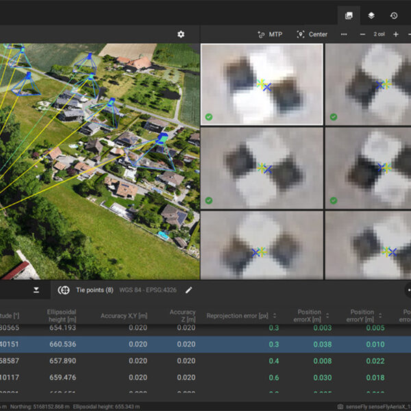
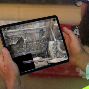
Pix4Dmatic is a Pix4D product optimized for accurate and fast photogrammetric processing for corridor and large scale mapping. It is designed to handle and process thousands of images with ease while maintaining survey-grade accuracy.
Accurate, fast drone mapping on a new scale
PIX4Dmatic is designed to work with the latest generation of drones for professional applications and transforms your large number of images into accurate point clouds, DSMs and orthomosaics.
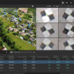
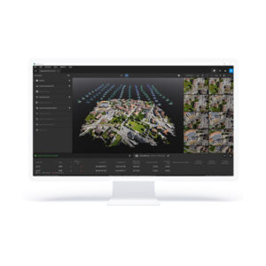
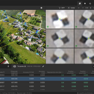
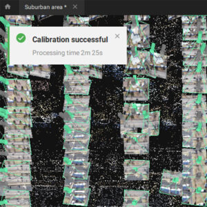
Bigger datasets, accurate results
PIX4Dmatic processes thousands of images while maintaining survey-grade accuracy, halving the processing time, without the trouble of splitting and merging.
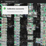
Fully automated processing
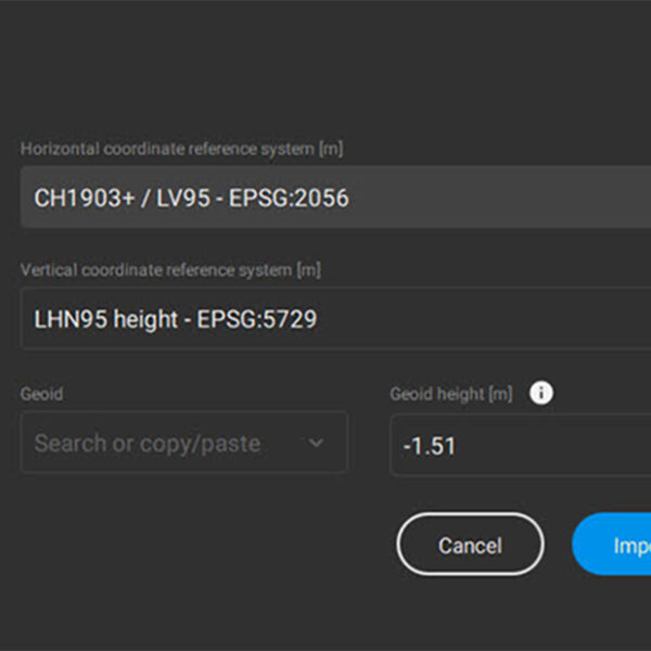
Developed in close-collaboration with surveyors and mapping professionals to streamline your workflow: import, process and assess the quality of a project in just a few clicks, and move seamlessly from PIX4Dmatic to PIX4Dsurvey.
Terrestrial workflow
Leverage the benefits of both photogrammetry and LiDAR technology. Process LiDAR and RGB image outputs from PIX4Dcatch for a full terrestrial workflow. Easy and desktop-based.
| mpn | LICENSE |
|---|