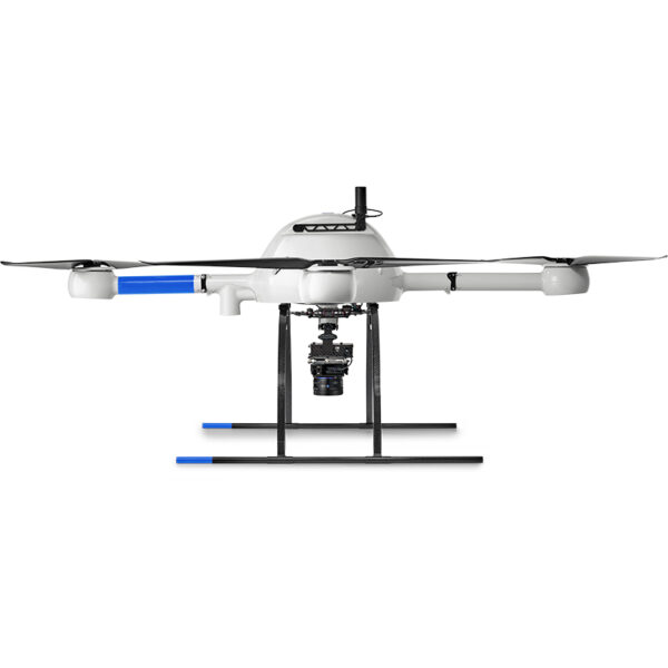
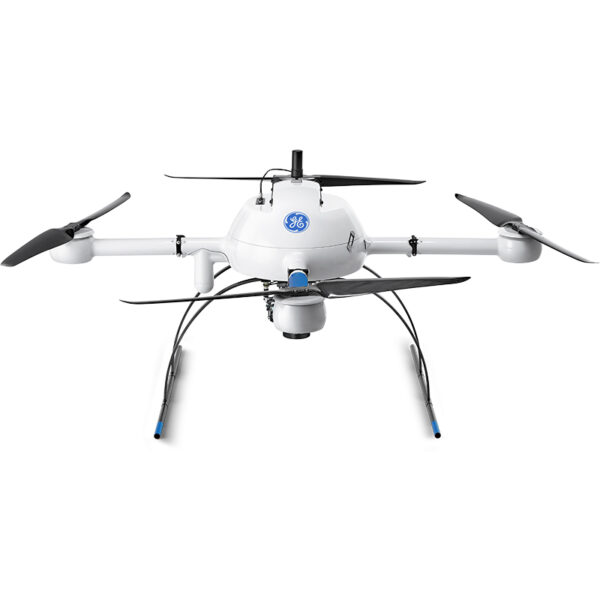
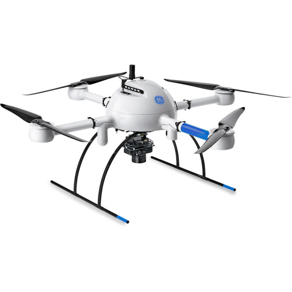
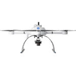
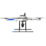
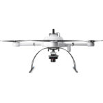
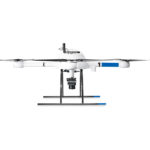
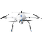
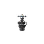
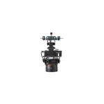
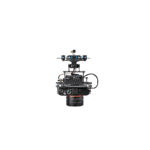
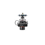
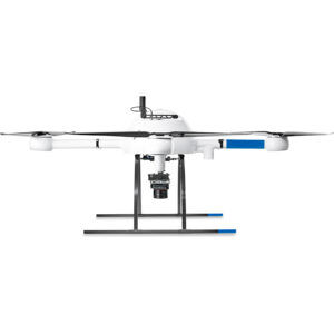
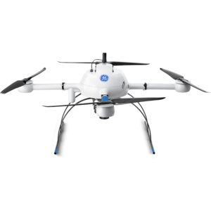
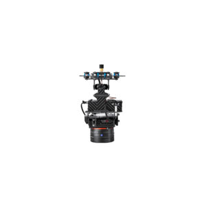
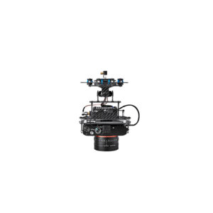
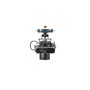
md4-1000 Aircraft x 1
Charger x 1
Flight Battery x 1
Carrying Case x 1
LED Light Rings
Integrated Cooling Covers
Mag-less Navigation
Encrypted Digital Data Link
mdRC Remote Controller x 1
Extended Communication Range Operation
Multiple Tablet Control
Remote ID Enabled
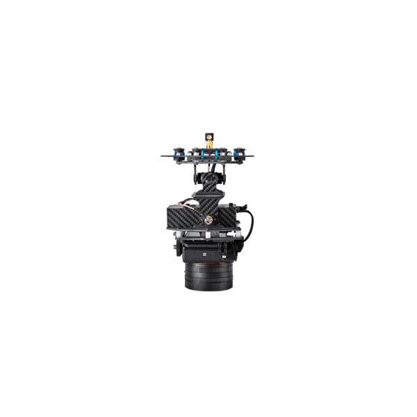
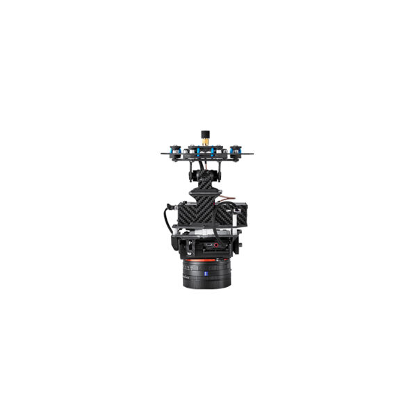
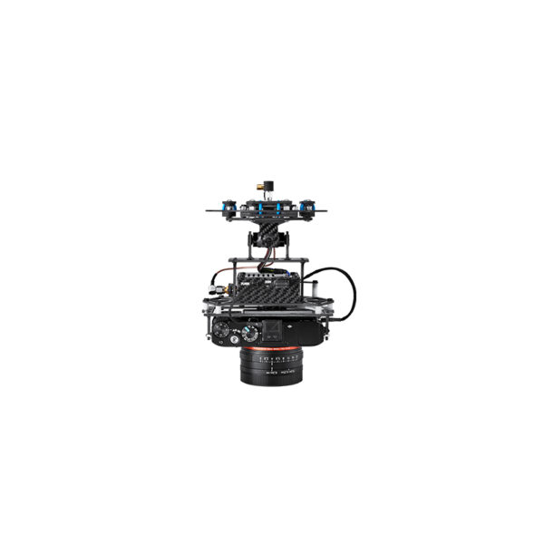
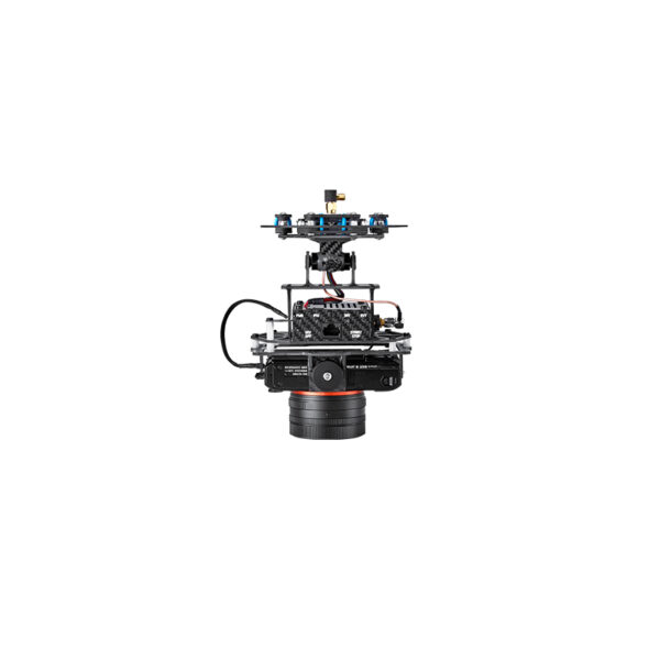
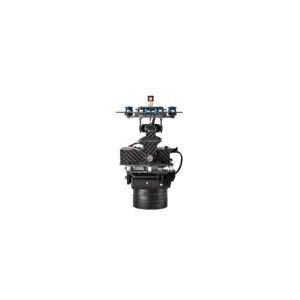
Sony RX1R II & Nadir Mount
Applanix APX-15 UAV DG
mdCockpit Tablet Software
Tap & Fly
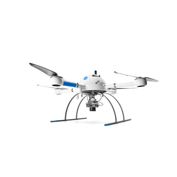
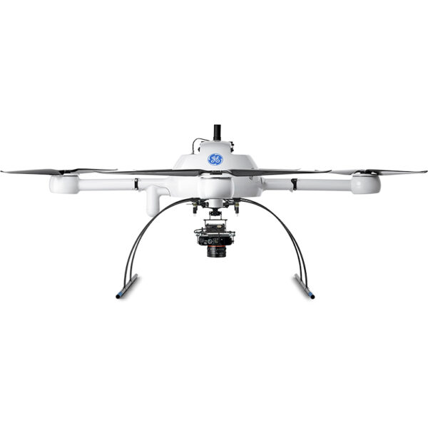


Microdrones mdMapper1000DG
$27,000.00
mdMapper1000DG will help you to achieve high levels of data accuracy, cover more ground in one flight, use less people and equipment on jobs – all without using ground control points.
Request a Quote
mdMAPPER1000DG: VERSATILE, AFFORDABLE DRONE PHOTOGRAMMETRY SURVEY EQUIPMENT
A COMPLETE UAV MAPPING SOLUTION THAT CUTS COST, SAVES TIME, AND PUSHES LIMITS – ACCORDING TO THE NEEDS OF YOUR DATA DELIVERABLE PROJECT
Conquer large surveying or mapping projects in a fraction of the time and master your geospatial data by putting direct georeferencing to work for you.
mdMapper1000DG will help you to achieve high levels of data accuracy, cover more ground in one flight, use less people and equipment on jobs – all without using ground control points.
Significantly reduce your time spent on projects. Deliver unparalleled data quality. Become invaluable to your clients’ success.
DIRECT GEOREFERENCING OR PPK DRONE SURVEYING: mdMapper1000DG WILL RISE TO THE OCCASION.
Direct georeferencing makes sense for pretty much any customer because it will pay for itself quickly and provide your business with dramatic cost savings over time.
With DG, you won’t need to install any ground control points (unless you want to install 1 or 2 to check your work later for quality control). You’ll collect your images and post-process in a fraction of the time. Your projects will require less people and equipment. You’ll safely tackle mapping jobs in dangerous locations.
Most important, you’ll deliver the best possible accuracy on projects where human safety and your reputation is on the line. Best of all, DG is selectable, AFTER data collection, as a post processing option… so you are only paying for it when your client or project needs it.
DON’T NEED DG? PROCESS WITH PPK; IT’S ALL SELECTABLE BY PROJECT NEED WITHIN MDINFINITY!
Microdrones customers asked for a workflow that could deliver excellent results with a handful of ground control points. We listened.
mdMapper1000DG fills an important niche for customers who may not be ready for DG, and are willing to set up 1 – 3 ground control points for their projects; simply post process data in PPK within the flexible mdInfinity cloud or desktop software.
And when your business, projects or services expand to require DG, you simply choose to process your data with DG in the mdInfinity suite.
SOLUTION COMPONENTS:
Platform: md4-1000
Payload:
Camera: Sony RX1R II
Georeferencing: APX-15 EI UAV
Software:
mdCockpit
mdInfinity
TECHNICAL SPECIFICATIONS:
Takeoff Weight (TOW): 5870 g
System Operation Temperature: -10 °C to 50 °C
System Accuracy:
Photogrammetry
Horizontal: 2 – 3 pixels
Vertical: 3 – 5 pixels
| Weight | 110 lbs |
|---|---|
| Dimensions | 48 × 40 × 42 in |