Mining
Collect timely georeferenced imagery to produce precise 3D copy of site for use in site surveys, volume calculations, traffic management optimization, road layout designs and more.
Mining Drones
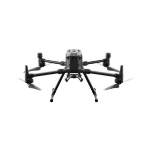
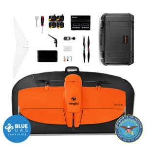
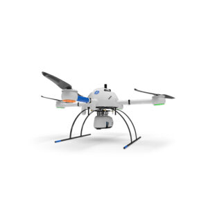
| DJI Phantom 4 RTK | DJI Matrice 300 RTK | WingtraOne Gen II | Microdrones mdLiDAR1000 | |
|---|---|---|---|---|
| Transport Weight | 12 lbs | 30 lbs | 13 lbs | 62 lbs |
| Transport Dimensions | 18" x 14" x 10" | 31" x 12" x 23" | 55" x 29" x 7" | 33" x 33" x 26" |
| Flight Time | 30 mins | 35 mins | 59 mins | 30 mins |
| RTK or PPK | RTK | RTK | PPK | PPK |
| Available Sensors | 20 MP Camera |
L1 LiDAR, P1 45 MP Camera |
RX1R 42 MP, a6100 20 MP |
mdLiDAR1000LR, mdLiDAR1000HR |
| Gimbal (moveable/rotating or fixed) | Movable | Rotating | Fixed | Fixed |
| Real-Time Video (Sensor/First-Person View) | Yes | Yes | No | No |
| Fixed Wing vs Multi-Rotor | Multi-Rotor | Multi-Rotor | Fixed Wing | Multi-Rotor |
| Obstacle Avoidance | Yes | Yes | No | No |
| Project Area Size | 40 acres | 50 acres per bat set |
RX1 at 520 acres a6100 at 600 acres |
Altitude & Speed Dependent |
| Weather Resisting Rating | N/A | IP45 | IP54 | N/A |
| Battery Charge Time | 1 hr | 1 hr | 1 hr | 1 hr |
| Number of Batteries for Operation | 1 | 2 | 2 | 1 |
| Cruise Speed | 22 mph | 22 mph | 38 mph | 11 mph |
| Wind Tolerance | 25 mph | 33 mph |
19 mph (ground), 27 mph (cruise) |
26 mph |