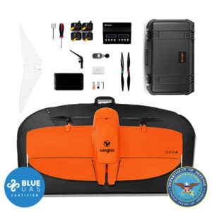
Micasense Altum Thermal + Multispectral Payload Kit

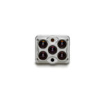
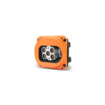
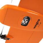


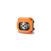
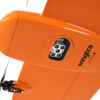
Wingtra MicaSense Altum (Thermal + Multispectral) Payload Kit (Gen 2)
$13,000.00
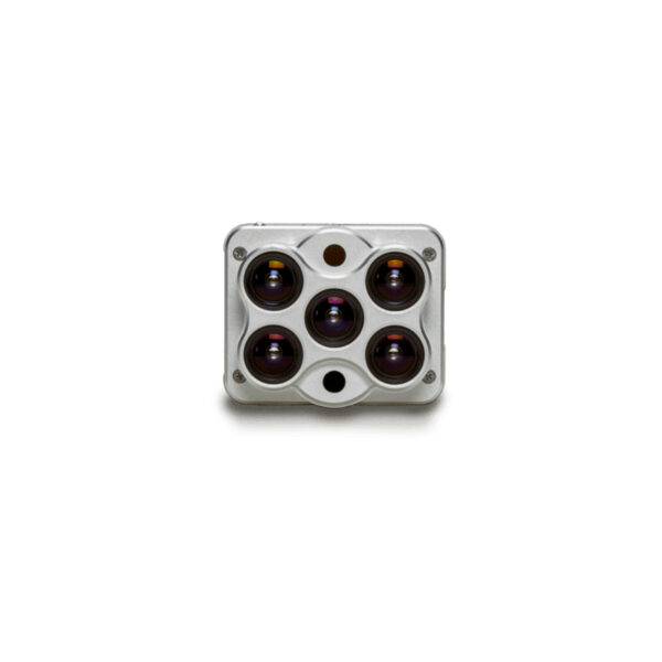
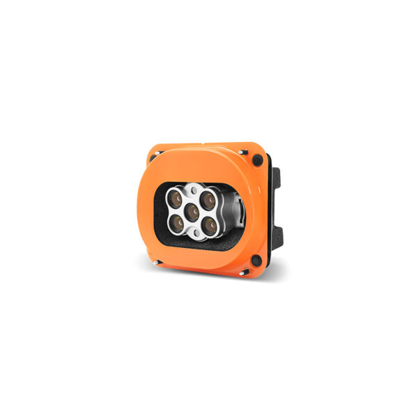
Combines a radiometric thermal camera with five high-resolution narrow bands, producing high-resolution multispectral and advanced thermal imagery in one flight for advanced analytics.
Request a Quote
The MicaSense Altum combines a radiometric thermal camera with five high-resolution narrow bands, producing high-resolution multispectral and advanced thermal imagery in one flight for advanced analytics.
Synchronized Imagery
The synchronized multispectral and thermal sensors are particularly useful for water management, hot-spot detection and environmental research.
Depending on the settings, the Altum also offers a larger coverage or higher accuracy than the MicaSense RedEdge-MX.
Together with the high-precision PPK module, Altum offers centimeter level accuracy.
Multispectral sensor:
5 bands (Blue, green, red, red edge, near infrared (NIR))
Thermal sensor:
Longwave infrared 8-14um (LWIR)
Lowest GSD:
3.0 cm/px Multispectral
Coverage at lowest GSD:
90 ha* at 80m altitude
Absolute horizontal accuracy down to:
4 cm** Without GCPs
Coverage at 120m:
130 ha* at 5.1 cm/px GSD
* at 70% side overlap
** Horizontal absolute accuracy (RMS). Achievable with a WingtraOne GEN II and its built-in GNSS PPK module. This level of accuracy is achievable under optimal conditions, on hard surfaces, using a well-established base station or data from CORS network. A minimum of three ground points should be used as checkpoints to verify and prove the accuracy of the project.
Technical specifications
Technical specification: 5 multispectral sensors (R, G, B, RE, NIR) + thermal band, 8 mm lens, nadir configuration
Payload weight (incl. mount): 570 g (1.26 lb)
Lowest possible GSD:
3.0 cm/px
1.18 in/px
Maximum coverage at lowest GSD:
Up to 90 ha (230 ac) at
70 m (229 ft) flight altitude
Maximum coverage at 120 m (400 ft):
Up to 150 ha (380 ac) at
5.1 cm (2.03 in) GSD
Horizontal absolute accuracy (RMS) with PPK (w/o GCPs):
down to 4 cm (1.6 in)
Vertical absolute accuracy (RMS) with PPK (w/o GCPs):
down to 8 cm (3.1 in)
Sensor type: 5 individual sensors: Red, Green, Blue, Rededge, Near-infrared
Sensor size x: 7.02 mm (0.28 in)
Sensor size y: 5.25 mm (0.21 in)
Mega pixel: 5 x 3.2
Shutter type: Electronic shutter
Pixel in x: 2046
Pixel in y: 1544
Focal length of lens: 8 mm (0.31 in)
Focal length (35mm equivalent): 40 mm (1.57 in)
Vertical field of view: 36.3°
Horizontal field of view: 47.4°
Minimal trigger time: 1 s
Minimal trigger distance 16 m (52 ft)
Sensor type: Thermal sensor
Sensor size x: 1.92 mm (0.08 in)
Sensor size y: 1.44 mm (0.06 in)
Mega pixel: 0.0192
Shutter type: Electronic shutter
Pixel in x: 160
Pixel in y: 120
Focal length of lens: 1.77 mm (0.07 in)
Focal length (35mm equivalent): 32 mm (1.26 in)
Vertical field of view: 44°
Horizontal field of view: 57°
Minimal trigger time: 1 s
Minimal trigger distance 16 m (52 ft)
GSD Overview
MicaSense Altum Multispectral
GSD at 120 m flight altitude: 5.1 cm/px (2.03 in/px)
Flight altitude: 120 m (400 ft)
Maximum frontal overlap: 78%
Maximum coverage: 130 ha (330 ac)
Lowest possible GSD: 3 cm/px (1.18 in/px)
Flight altitude: 70 m (230 ft)
Maximum frontal overlap: 63%
Maximum coverage: 80 ha (200 ac)
6.0 cm/px GSD: 6 cm/px (2.36 in/px)
Flight altitude: 140 m (460 ft)
Maximum frontal overlap: 81%
Maximum coverage: 160 ha (400 ac)
8.0 cm/px GSD: 8 cm/px (3.15 in/px)
Flight altitude: 187 m (610 ft)
Maximum frontal overlap: 86%
Maximum coverage: 210 ha (520 ac)
Highest possible GSD: 50 cm/px (19.69 in/px)
Flight altitude: 1166 m (3820 ft)
Maximum frontal overlap: 95%
Maximum coverage: 1140 ha (2820 ac)
GSD Overview
MicaSense Altum Thermal
GSD at 120 m flight altitude: 81 cm/px (32 in/px)
Flight altitude: 120 m (390 ft)
Maximum frontal overlap: 78%
Maximum coverage: 130 ha (330 ac)
Lowest possible GSD: 47 cm/px (19 in/px)
Flight altitude: 70 m (230 ft)
Maximum frontal overlap: 63%
Maximum coverage: 80 ha (200 ac)
6.0 cm/px GSD: 95 cm/px (37 in/px)
Flight altitude: 140 m (460 ft)
Maximum frontal overlap: 81%
Maximum coverage: 160 ha (400 ac)
8.0 cm/px GSD: 127 cm/px (50 in/px)
Flight altitude: 187 m (610 ft)
Maximum frontal overlap: 86%
Maximum coverage: 210 ha (520 ac)
Highest possible GSD: 791 cm/px (312 in/px)
Flight altitude: 1166 m (3820 ft)
Maximum frontal overlap: 95%
Maximum coverage: 1140 ha (2820 ac)
| Weight | 3.5 lbs |
|---|---|
| Dimensions | 39 × 29 × 28 in |